Saturday, April 26, 2008

Wollongong Road The Road to Illawarra


To understand the history and importance of Wollongong Road as it relates to Rockdale then you need to read James Jervis’ authoritative work Illawarra: a Century of History.
The following extracts are taken from that document and Rockdale Its Beginning and Development by Phillip Geeves and James Jervis and revised 1986 by R.W. Rathbone.

“In 1831 it occurred to Major Mitchell The Surveyor-General of NSW) that a more direct line of road to Illawarra might be constructed from Sydney, more or less parallel to the coastline. Writing to the Colonial Secretary on August 30, 1831, the Surveyor-General said: ’The idea of a still more direct line of road to Illawarra from Sydney however, has occurred to me from a very able survey of the intervening country lately made by Assistant Surveyor Govett; this would cross the lowest ford on Cook’s River (where the settlers of that district wish to have a road) and George’s River by a ferry across a breath of two hundred and fifty yards. . .’ ”
It should be pointed out that at that time the road to the South Coast was via Appin to Wollongong. Local settlers wanted a shorter route but at that time the “wild and desolate gullies beyond Port Hacking” had proved a deterrent to more than one unhappy traveller.
“The Surveyor general furnished a report on the proposal to construct a road direct to Illawarra in 1843. Mitchell stated that he had proceeded on May 3 to mark a direct line of road along a continuous range which he had ascertained to be one eligible after studying a plan of the country made by Govett. The road between the dam at Cook’s River and George’s River was much needed . . .”
And so the road went through. It had various names, sometimes Illawarra Road, sometimes Wollongong Road and, on very early maps, it appears with the grandiose title “Sir Thomas Mitchell’s Line of Road to the Illawarra”. Convict gangs built it, following the pegs that the surveyors had driven into the earth, keeping to the benchmarks that had been blazed on trees. The road began on the southern side of Cook’s River dam adjacent to “Tempe House”. It wound its way across the alluvial flat to the reverse side of the Knoll on which Arncliffe came to be built. From there it followed the ridge, the line of which is now Forest Road, and wended its way to the crossing of the Georges River at Lugarno. The surveyors had seen some glorious views, reminiscent of Europe; it is small wonder we now have suburbs with names like Lugarno and Como.
When we drive from Arncliffe to Lugarno the winding road is a reflection of the primitive conditions under which it was first built. The immense number of age-old trees that were felled in the course of its construction can hardly be imagined; in fact it supplied the entire colony of the time with timber and charcoal for many years.
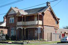
The photos are to make you curious, they are just a few of the buildings dotted along Wollongong Road, some have gone, others have not been touched in nearly one hundred years and others, have been lovingly restored by their owners. I hope this encourages you to walk your own local street and see just what is still there; you just might be pleasantly surprised.

Friday, April 25, 2008

Pioneer Buildings (Before 1884).


There are about 25 to 30 Pioneer buildings still surviving in Rockdale which were built prior to the Illawarra Rail line being opened in 1884.
Many have survived and are still worthy of their heritage status, unfortunately some have fallen in to a bad state of repair but are still worth conserving. Of these buildings there are four that are the most important pioneer building in our city. These are-
  • Tempe House 1836. 1 Princes Highway Arncliffe. This palladian villa, built of rendered stone quarried from a nearby hill is the most historically significant building in Rockdale. Built in 1836 to the design of colonial architect John Verge (1782-1861) whose other work include Tusculum at Potts Point, Camden Park at Camden, Denham Court at Ingleburn, Elizabeth Bay House at Elizabeth Bay and Toxteth Park at Glebe, as a country retreat for wealthy Sydney merchant, Alexander Spark, it was so favoured by Spark that it became his principal residence and he died there in 1856. It was purchased by the Catholic Archdiocese of Sydney in 1881. "Tempe" is the oldest building south of the Cook's River. It is the building from which the suburb of Tempe takes its name. It was, at one time, used as a school by Caroline Chisolm. Recently it has been restored an is an excellent example of the work of a very important colonial architect.
  • Lydham Hall 1860. 18 Lydham Avenue Rockdale. Lydham Hall was built in 1860 of material quarried locally by Swedish stone mason, Sven Bentson, for a local wealthy butcher, Joseph Davis. It is one of the few substantial domestic buildings erected in Sydney during the gold rush periods and represents an excellent example of the transition from the simple Georgian style of architecture to a more elaborate Victorin style. It stands on the highest point of land between the Cook's and George's River. At one time the home of David Stead who gave the suburd of Banksia its name, it was also the home of the distinguished authoress, Christina Stead.
  • Wilson's Farm House 1855. 310 West Botany Street Rockdale. Wilson's Farm House is the last surviving example of the modest pioneer homes built along the banks of Muddy Creek. Constructed of locally quarried stone with rendered rubble internal partitions, it originally had a detached weatherboard kitchen. It was built somewhere about 1855 by James Wilson, formely overseer to Colonel Johnson of Annandale, on land previously owned by John Bowmer. Wilson lived there until his death in 1869. His widow remained in the cottage until 1880 and the property was still owned by the Wfamily as late as 1910. In more recent times it was the centre of a Chinese market garden until its aquisition by the then Cumberland County Council for county open space. Although the building is now owned by Rockdale City Council, it is in fair condition, though poorly sited and in need of a dedicated Conservation Plan to make sure it is conserved for the future. It is an important piece of our cities colonial past that unfortunately is being neglected by Rockdale Council.
  • Forsythe 1868. 57 Hannam Street Turrella. (pictured above) This particularly attractive free stone home was built in 1868 by Samuel Jeeves, a wool scourer, who used the waters of the nearby Wolli and Bardwell Creeks to wash the fleeces bought from the numerous slaughter houses located in the immediate vicinity. This activity was moved to Botany in the 1880's. This building has been well cared for and has been renovated in the past few years. Because of its age, its association with an important early industry, its method of construction, its appearance and its architectual merit it is a worthy colonial home worthy of conservation.
The following list of Colonial buildings are all worthy of heritage conservation and an important part of our cities history:
  • Pembroke Cottage 1852. 9 Bennett Street, Kingsgrove.
  • Mill Cottage 1869. 29-31 John St, Arncliffe.
  • Banbury Cottage 1880. 23 Chandler Street, Rockdale.
  • John Downey's Cottage 1858. 14 Downey Street, Bexley.
  • Highbury 1880. Queen Street, Arncliffe.
  • Mimosa 1886. 586 Forest Road, Bexley.
  • George Perry's home 1880. 666 Forest Road, Bexley
  • Joseph Walz's home 1880. 25 Frederick Street, Rockdale.
  • The old Walker home 1870. 28 Walker Street, Arncliffe.
And three free stone buildings all built in about the 1870's:
  • 211 Stoney Creek Road, Kingsgrove.
  • 112 Slade Road, Bardwell Park.
  • 7 Robertson Street, West kogarah.
All these buildings are if you are interested in our Colonial past, worth having a look at. It is amazing just how much history is here in our backyard.


The source of this information was originally prepared by Ron Rathbone when as Mayor of Rockdale City Council he tried to have council recognise the importance of our cities history. The information was published by Ron Rathbone in 1978, and is available from Rockdale City Council's history library.

Monday, April 21, 2008

LYDHAM HALL

"Lydham Hall" 1860
18 Lydham Avenue, Bexley 2207

Lydham Hall is a free stone family home built in 1860 of materials quarried locally by Swedish stone mason, Sven Bengton, for wealthy master butcher, Joseph Davis. It is one of the few remaining domestic buildings erected in Sydney during the period of the gold rushes and represents an exellent example of the transition from the simple Georgian style of architecture to a more elaborate Victorian style.


It stands on the highest point of land between the Cook's and George's Rivers where it commands extensive views over Botany Bay. This house is an outstanding early pioneer home, which has been restored faithfully to that early period. It is currently owned by Rockdale City Council and is managed by the St George Historical Society.

At one time it was the residence of David Stead, internationally known fisheries expert and naturalist who gave the suburb of Banksia its name. It was also the childhood home of the distinguished authoress, Christina Stead.
The building is on Rockdale City Councils heritage list and is open on weekends for viewing , times etc are available from Rockdale Council. It is worth a look especially when the roses in the rear garden are in bloom.
The building has been well maintained by the council, but it could do with a properly prepared conservation plan and a more appropriate front fence put in place more in keeping with the style and age of the building. Along with Tempe House this building is one of our cities most important links with our past.

Friday, April 18, 2008

My Favorite Little School House


These photos were taken at Arncliffe Public School, and this little school house which has remained virtually unchanged in over 129 years is my all time favourite heritage building in Rockdale. This stone and iron building is exactly what we all imagine school buildings to be back in the 1800's and if you go there today the kids are still using it just as they did back then, it is a real treat to see when school is in, with school bags hanging on hooks on the verandah and the noise of the kids learning coming out of the windows. Another piece of our beautiful history still being used today.

Tempe House During Restoration


These photos where taken during the restoration of Tempe House and the Chapel and the grounds around the house. Included are three showing the murals that were discovered under layers of old paint on the walls of the chapel. The work carried out by all those trademan is unbelievable especially if you had been fortunate enough to see Tempe House when it was open to the public back during the 1990's. We are still waiting for the new owners to open the house and chapel to the public now that the restoration work is complete. We were hoping that it would be during Heritage Week 2008 but that does not look like happening, maybe later on this year we will see Tempe House in all its glory.
We do hope you enjoy these photo's and that they have wetted your appetite to get you to see Rockdale Cities greatest treasure.

Vanishing History

West Botany Street Arncliffe

Wollongong Road Arncliffe

Fairview St Arncliffe PalmTrees


Edward St Arncliffe


The above photographs are just some of the beautiful period homes that have been demolished in and around the City of Rockdale.

Arncliffe, A Garden Suburb


Arncliffe is a small leafy suburb situated about 8km south of the centre of Sydney on the way to Cronulla, its many natural attributes are more than complimented by its considerable collection of fine period homes.

The suburb is divided by a high ridge that can leave you with panoramic views over Botany Bay or across the city skyline, in some places you can enjoy both. The area is serviced with good public transport that gives access to the city by train in about 11 minutes, and a number of major shopping centres are to be found close by.
But one of the best kept secrets of this little known suburb is its character, with period houses in lovely tree lined streets sorrounding beautiful parks. Wolli Creek and Bardwell Valley are areas of untouched natural bushland where residents can spend tranquil hours bushwalking.
Even with its natural aspect, Arncliffe offers its residents a cosmopolitan lifestyle with a mixture of cultures living in harmony - a real village atmosphere. Many elderly residents have lived all their lives in Arncliffe - some can even remember the steam trams that ran from Arncliffe Railway Station up Wollongong Road to Bexley. The area has had its booms, but in particular it flourished in the 20 or so years after Federation - it was a much sought after area, especially by the gentry of the period. From about the depression until only just a few years ago though, the area was virtually forgotten. Only recently, young couples looking for their first home started discovering the wealth of untouched Federation cottages and Californian Bungalows with the odd Victorian Villa just waiting to be restored to their former glory, and for many they could now afford a piece of this country heritage many thousands of dollars below what was being asked in areas like Burwood, Balmain and Chatswood.
The history of the area stretches back to the 1820s when James Chandler, who arrived in Sydney in 1820 as a free settler, purchased 100 acres of land near King's Grove, one boundry of which was the creek now known as Wolli Creek. In 1822 he was granted a further 1200 acres, next to his 100 acres, which he called Bexley, an area which would now cover Bexley, most of Rockdale, and much of North Bexley and Kogarah. Reuban Hannam, an ex-convict, was rewarded for his labors as the overseer of Government brickmakers, by becoming a landholder, with one grant of 100 acres along the banks of Wolli Creek. His son David Hannam, who played an important role in the development of the area, was granted territory just south of Cook's River. Although this grant was dated August 31, 1833, there is good reason to believe that, after his marriage at St Peter's, Campbelltown, in 1828, Hannam brought his bride to his Cook's River property. In that same year, 1828, Alexander Brodie Spark purchased Packer's Farm, on the south bank of the Cook's River and built a substantial sandstone residence called Tempe.
Without a doubt, Tempe House is the jewel in the crown of the St George area.
Built in 1836 for Alexander Spark, it used a design by John Verge. one of the great Colonial Architects. Verge also designed Tusculum at Potts Point, Camden Park at Camden, Denham Court at Ingleburn, Elizabeth Bay House at Elizabeth Bay and Toxteth Park at Glebe. This property differs in that it still retains almost all of its original grounds and even some of the original landscaping. For Tempe House, Verge used an Italianate style of striking composition incorporating semi - circular verandahed bays supported by wooden Tuscan columns. Pediment gables are a feature of the roofline. Spark chose the site after searching for " an area unspoilt by man". He named the area Tempe after the beautiful Vale of Tempe that lay beneath Mount Olympus in Greece.
In 1988, the property was purchased by Qantec, a subsidiary of Qantas. Their intention was to restore Tempe House as part of the re development of the site but unfortunately that did not happened and unfortunately we did in that time see the demolition of the original girls school and its associated buildings . In the mid 90's the Tempe House site was re sold to a developer and this time thru the efforts of the Rockdale District Heritage Association council made it a condition of the development approval that Tempe House, the Chapel and the ground including Mount Olympus be restored as an early stage of the re develoment of the site. Tempe House is a rare and beautiful survivor from our Colonial Past. Its restoration and preservation, including that of its grounds, is of the utmost importance to all Australians and we congatulate all those involved in its restoration.
David Hannam's property lay directly to the rear of Tempe. When Rocky Point Road and Forest Road were built, they both ran through David Hannam's grant. For years no name was given to the area, but it was eventually called Arncliffe. Surveys of the area were made by William Meadows Bronrigg, surveyor and draughtsman of Newtown, and a friend of Spark's. It is believed that he suggested the name, which means hard cliff, a reference to the rocky prominences and knolls that dominated the land and were to provide laborers with work through to the next century.
In the early years of settlement the only way across the Cook's River was via a punt driven by Old Willy, Spark's boatman. Spark's wealth and generosity, and the beauty of his retreat attracted many settlers, though the access was difficult. At first, the southern side of Cook's River gave promise of becoming a most select area, peopled with gentleman farmers and wealthy merchants. However, by 1841, the economic depression caused large land owners to begin to break up their estates. In 1856, the land was being offered to "market gardeners and small capitalists".
An experiment to dam Cook's River, to control the flow of sea water, led to the building of an earthen dam just east of the present bridge. The scheme failed as the dammed water stay brackish, but the dam provided a much needed bridge to the south and development progressed. The suburb of Arncliffe flourished from about 1890 to about 1935, at which time the majority of the houses were built, they are mostly Federation and Californian Bungalow in style with a spattering of Victorian homes. There are quite a few large Victorian and Federation Gentleman's mansions in the area, but like a lot of areas close to Sydney, it went through a phase of being unfashionable and became just another working class suburb, and has suffered from the tag of an ethnic enclave.
But like the mythical Phoenix rising from the ashes, Arncliffe is starting to undergo a metamorphosis as people discover its proximity to the City Centre and to the beaches and it's wealth of untouched period homes. As more and more of these cottages are restored to their former glory, maybe, just maybe more people will come to appreciate the history and character of this area and the wonderful varied lifestyle that comes from areas where the residents no matter what their background get together to say this is a great place to live.
Over the last few years The National Trust and The Heritage Council have placed a number of properties on their various registers and Rockdale City Council and the Department of Planning have put in place a Local Environmental Plan to further protect some of this areas historic buildings. Hopefully this will bring about some positive guidelines, to help protect the area from unsympathetic development and to restore Arncliffe to its status as the beautiful Garden suburb envisaged by its forefathers. For more information on old houses and their restoration you can contact the Rockdale District Heritage Association either by email at rdha@netspace.net.au. The Association provides information about traditional colour schemes or period house restoration, other activities include history walks in the area.

Thursday, April 17, 2008

Rockdale Our Heritage

Rockdale is a great City to the south of Sydney, approx 10-12 kms (15 minutes by train) from the Sydney CBD. It consists of the suburbs of Arncliffe, Banksia, Bardwell Valley, Bexley, Brighton le Sands, Carlton, Dolls Point, Kyeemagh, Monterey, Ramsgate, Sans Souci, Sandringham & Wolli Creek. It is full of beautiful period homes, loads of parks and natural open space, sits on Botany Bay and we love it.
So the Rockdale District Heritage Association want to share some of its history,
quirky bits, bad bits, lost bits with whoever is interested. So this blog will over the coming months post different aspects of our city to share with you. We hope you enjoy it as much as we enjoy bringing it to you.